Image Processing
Image Processing -finding hidden treasures - an introduction to image processing
see also
contents of entire Earth and Beyond Course...
Before You Start! -How to Use the Image
Processing Exercises
Venus (fully worked example)
Hawaii(fully worked example)
Cyclone (partly worked)
The Pyramids
Flooding on the Zambeze River
Mt. Pinatubo Volcano, Phillipines- locate ash
flows
Niagara Falls
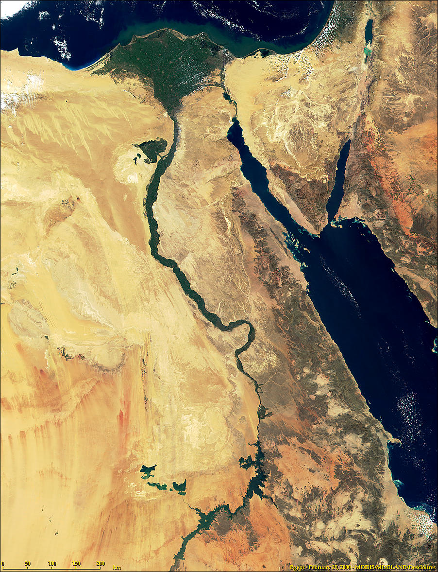
Nile River , Egypt
Nile River Delta
Nile River Delta Detail
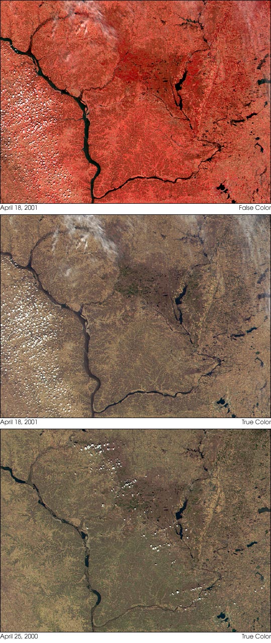
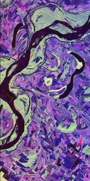
Mississipi River USA Image #1 in Flood
Mississipi River USA Image #2 in Flood
Mississipi River USA Image #3 in Flood
St. Louis, Missouri USA in Flood
Freeware program IrfanView
is used for these exercises -download from website
Before You Start - How to Use the Image Processing Exercises
- Copy and Install the image processing program Irfanview on you computer
- click on each of the images to open the large size version and copy them to an image folder on your computer
- keep your browser open and follow the instruction on how to process the images - have fun!
Satellite Images can be very useful in providing valuable information.
But the human eye is not very sensitive to subtle changes in brightness and colour. We can use image processing to overcome this difficulty and to expose the hidden treasures of information found in satellite images .
Image Processing works because, unlike photographs, the colours in satellite and digital images are represented by numbers.
The image is made up of little squares called pixels, the more pixels, the more detailed the image. Each pixel is represented by three numbers corresponding to the three primary colours.
Currently there are two common methods of describing the colours; namely Hex and RGB codes
CLICK ON ANY IMAGE FOR FULL SIZE AND THEN COPY IT TO YOUR COMPUTER
Example One: Studying the rocks on Venus - an example of image
enhancement
This example uses false colour image processing to bring out hidden
features.No-one has been able to set foot on Venus to sample the rocks and ages of the craters.
To our untrained eye a black and white satellite image taken by a Russian Satellite many years ago shows little in the way of detail

The featureless surface of Venus gives little indication that the rocks and craters are of several ages
 of the image")
STEP 2. Open the image venus 1.gif
STEP 3. click on image, choose palette (bottom of menu), click on edit palette
STEP 4. select the grey square seven squares from the left
STEP 5. double click on this square
STEP 6. choose a bright colour from the choices given ( I chose yellow)
STEP 7. double click in the new colour
STEP 8. click O.K. then click O.K. again
YOUR ENHANCED IMAGE SHOULD LOOK LIKE THE ONE SHOWN BELOW:

 Change some more colours...
 With each successive colour more detail appears...
  Until all the hidden detail is revealed.
This information can then be interpreted by a geologist:
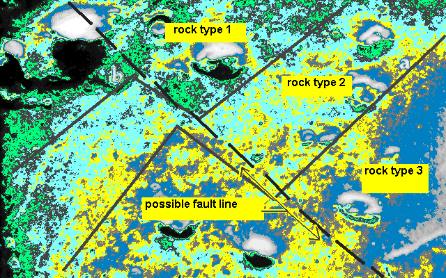
From the final image it would appear that here are three distinct rock types or ages
each of which appears to be offset by a crack or fault not quite at right angles
to the contacts (boundaries) of the rock groups.
This is common on earth with rocks that are under some tension
Example Two: Hawaii exploring is waters
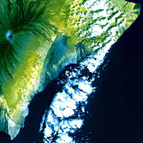
Mona Loa on the big island of Hawaii is the highest mountain on earth but we don't think of it that way because the bottom half of it is under water. It has some of the most diverse climate on the planet ranging from tropical rainforest around its biggest town Hilo (infamous for being frequently destroyed by tidal waves) ; to clear sub-arctic conditions at its summit to desert conditions in its rain shadow.
CHANGING THE IMAGE TO 256 COLOURS

Open IrfanView
Open the file:Hawaii1.jpg This is a multi-spectral can image of Hawaii in false colour from Landsat 5 downloaded from a NASA site in Maryland, West Virginia.
The image is supplied in 16 million colours and you will be instructed how to quantize it to 256 colours.
The circular feature on the left is the crater of this enormous volcano.
Go to Image --> Decrease colour depth --> the program will suggest the number of colours be reduced to 256--> click O.K.
NOW WE CAN ENHANCE THE IMAGE TO FIND OUR MORE ABOUT THE WATER

Notice the water in this image has been changed to black.
Is there any standing water on the island itself?
The answer is yes but the differences are too subtle and the pixel size too small for the human eye to detect. Most of the ocean and some of the volcanic peak appear blue indicating standing water
Go to Image -->Palette Entries (you will have to do this three times)
First time: Click on the square shown in the top left hand corner andchange the black to blue
Click O.K.
You can now see palces that have cold water - notice the island is surrounded by cold (deep) water but also that there is a supply of cold (due to the altitude) water in the crater itself
Second time: Click on the dark square 11 down and 6 from the left and change it to red
This shows warm water. Notice it is a very narrow band around the island. The ocean becomes very deep very quicklt around the island.
Third time: Click on the dark square 8 from the left in the top row. Change it to aqua.
This colour shows water in creeks and streams. some of it is partly obscured by cloud but the enhancement alows you to trace the hidden water courses.
TRY SOME MORE IMAGES:
Finding zones of maximum turbulence in a cyclone
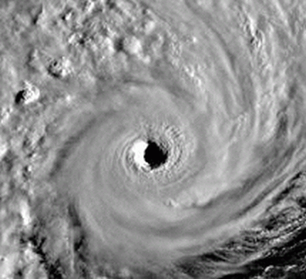
This exercise uses the "Sharpen" feature of image enhancement. It is a mathematical routine that identifies and slightly darkens edge features. It is used to bring out outline shapes from blurry of fuzzy images but must be used with care . Overuse results in the image becomming granular.
Open the image cyclone1.jpg in IrfanView
Use Image-->Sharpen then reduce the colour depth to 16 colours -->
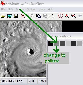
Continue changing colours to see if you can pick up more subtle changes in the cyclone
TRY SOME ON YOUR OWN:
The Pyramids
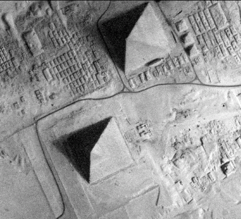
Some people think the pyramids at Giza in Egypt where made by building, then removing a giant artificial hill.
Disturbed sand comes up as a lighter colour
Reduce the image of the pyramids to 16 colours .
Look for light regions and consider where would be the most logical place to put an artificial hill.
Test to see if there is any evidence of a large disturbed area.
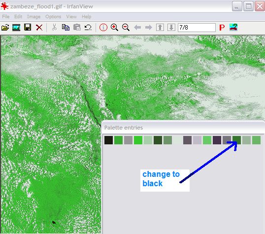
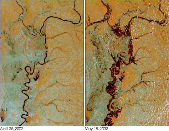
Predicting Floods on the Zambeze River in Africa

Reduce the colour depth of the Satellite image of the Zambeze River to 16 colours.
The file is zambeze_flood1sm.gif
Work on changing the darker colours to black to make the areas prone to flooding stand out.
Need a hint?
Check your answer against an image of the Zambeze River actually in flood!
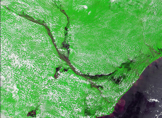
Notice that while our image enhancement easily outlines flooding areas on the delta, cloud cover makes us miss the major tributary on the top right hand side!
Remote sensing and satellite imagery must always be followed up with ground checks!
Additional Images from the USGS:
Mt. Pinatubo, Philipines
Enhance the volcanic ash to determine the dominant wind direction at the time of the eruption (more damage downwind).
Easiest to reduce to 16 colours first) but for a real-life image processing experience try to highlight the windblown ash flows using 256 colours
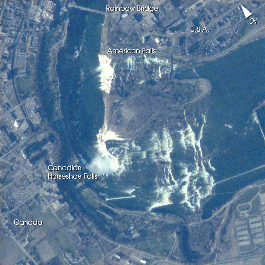
Niagara Falls -Canada / USA border
Images of Rivers in Flood:
Nile
Nile Delta
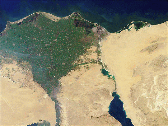
Nile Delta -detail
Mississippi 1
Mississippi 2
Mississippi 3
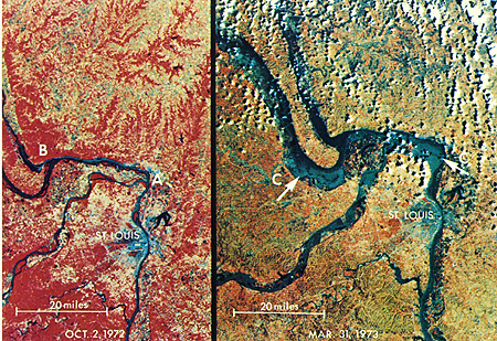
St. Louis , Missouri USA in a serious flood